HAROLD’S PARK FARM
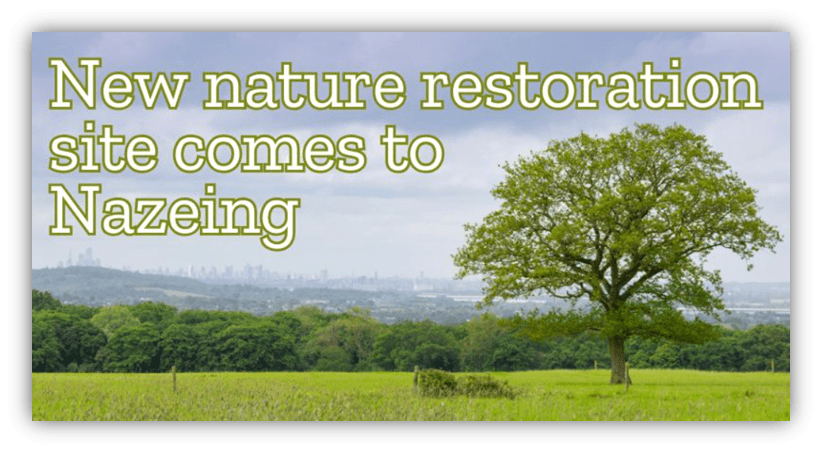
This was the headline in our local news. Nature restoration company, Nattergal have exciting plans for an old equestrian centre in Nazeing.
With two ancient woodlands and a selection of old hedges, the site will see an explosion of nature recolonising the ecologically degraded ex- agricultural fields as natural processes are re-established. Harold’s Park Wildland will become one of the leading nature sites in the region and is the third site owned by Nattergal. You can see more about them at https://www.nattergal.com/harolds-park-wildland The 206-hectare Green Belt site is steeped in history and boasts fantastic views of the London skyline (see above photo).
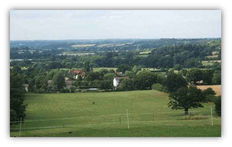
View from Harold’s Park northwards to Nazeing and Hertfordshire.
But what is the history of this area, known as Harold’s Park Farm?
The farm is named from King Harold, who owned land in Waltham Abbey before the Norman Conquest. It is situated in a superb high location with views over four counties – Hertfordshire, Essex, London and Kent. Though always farmed as a single enterprise, its 512 acres were spread across three parishes in west Essex – Waltham Abbey, Nazeing and Epping Upland. You can learn about the connection of the village to Waltham Abbey and King Harold in our History of Nazeing -Part 1 available at Publications – Nazeing History
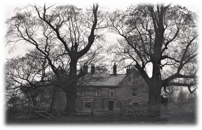
Photo of the old farmhouse from around 1900
The timber-framed farmhouse has 11th-century foundations but was mostly built in the 1700s and extensively altered over the years. It is situated just out of Nazeing Parish in Waltham Abbey, although access has been from Bumbles Green for at least 200 years.
The 1912 Ordnance Survey map (below) showing the house and farmyard sitting just outside the Nazeing parish boundary, in the Waltham Holy Cross part of the farm.
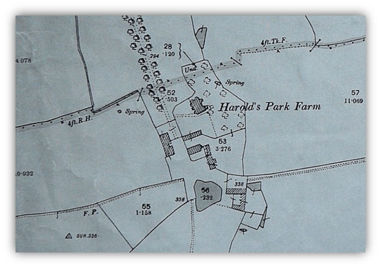
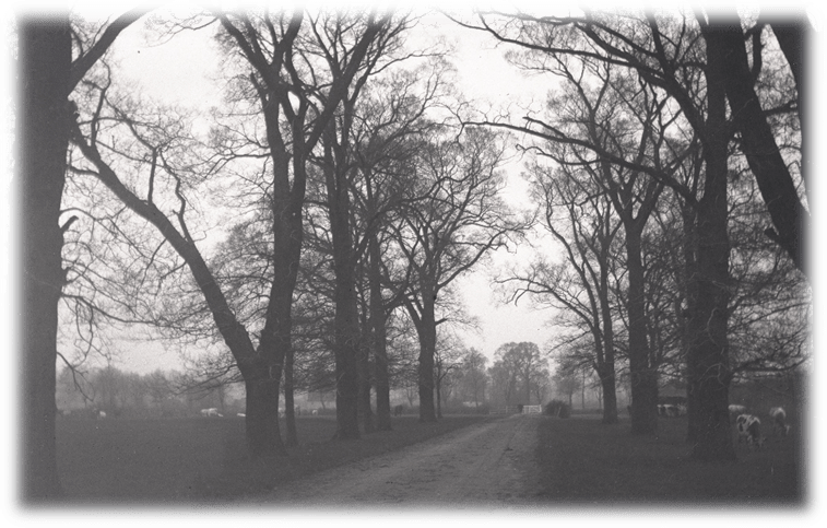
Photo from around 1900 of the drive way from Harold’s Park Farmhouse to Bumbles Green, with a gate to keep the livestock in.
“On the top of the hill is an ancient farmhouse, and leading to it is a fine row of elm trees on each side of the road, forming a pretty avenue” – William Winter, Memories of the Pilgrim Fathers (1882) The trees were lost to Dutch elm disease in the 1970s.
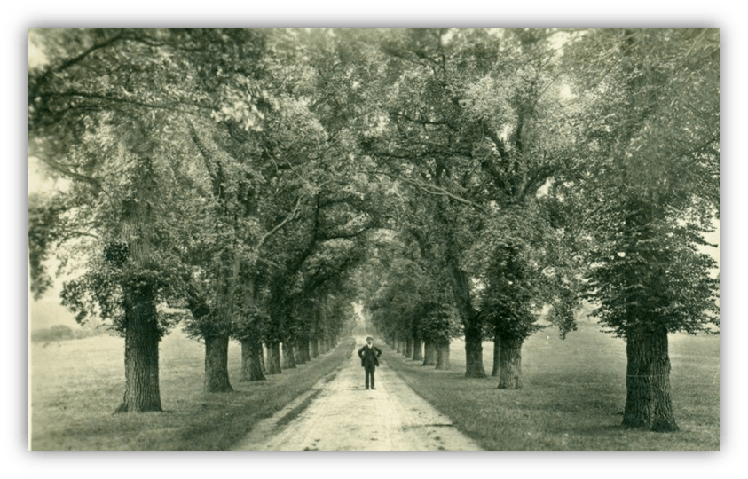
View from Bumbles Green circa 1910, (below) looking up the hill towards Harolds Park Farm
Local people will remember Harolds Park Farm as a Horse Riding and Christmas Tree business. The Mackie family came to the village in 1953. John Mackie changed the farm to purely arable because it was less labour-intensive. John’s son George took over the farm and diversified into horse-riding and Christmas tree businesses to augment its income. After his death, his son Hector tried to carry on but didn’t succeed and the farm was put on the market.
In 2023 Harold’s Park Farm embarked on a new and exciting phase in its history when it was bought by Nattergal, a company specialising in nature restoration. They have renamed it Harold’s Park Wildland and state: ‘We plan to transform the low productivity arable fields, intensive grassland and Christmas tree plantations into an abundance of biodiversity and wildlife.’ You can see more about them at https://www.nattergal.com/harolds-park-wildland
Our research into the history of the farm was based initially on the 1966 Abstract of the title of Mr J. Mackie for Harold’s Park Farm Nazeing, kindly lent by John Carr, and is supplemented by many other sources including an invaluable database compiled by Nazeing History Workshop member John Garbutt from dozens of sources such as land tax and poor relief records.
THE FARM
Through maps and other sources, we can get an idea of how Harold’s Park Farm evolved in the century before the arrival of John Mackie
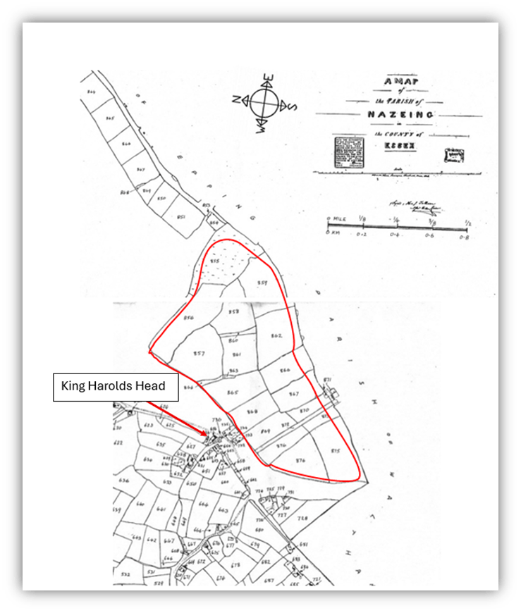
The 1847 Tithe Award
In 1847 the whole parish of Nazeing was surveyed so that tithes, which had previously been delivered to the vicar in kind, could be paid in money. On the map below, the part of Harold’s Park Farm situated in Nazeing is outlined in red.
Nazeing Enclosure Award of 1858
Throughout England, areas of ‘waste’ were enclosed and added to the land of the wealthier landowners. It had long been the right of cottagers to graze stock on riverside meadows and roadside verges – an untidy custom which was seen by the early Victorian official mind as waste in every sense of the word. Enclosure awards enabled landowners to gobble up small parcels of land next to their existing property, while the poorer commoners received minimal compensation for losses which in their subsistence economy could be of vital importance. This was the case In Bumbles Green, for the area outlined in green on the Tithe Map. Most significant in Nazeing was the enclosure of the marsh and the mead near the River Lea – almost 400 acres of rich grazing land where commoners had valuable rights called cowleazes.
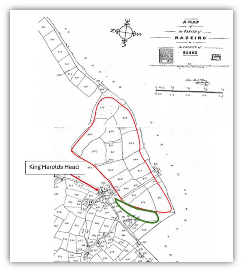
The area in green on this map of 1847 (above) was incorporated into Harold’s Park Farm in 1858. It had previously been a source of grazing available to villagers. In total one tenth of land in Nazeing was enclosed, 450 acres. 20 acres were incorporated into Harold’s Park Farm.
In 1861 the cottagers were given just 4 acres in compensation for this loss. These included the Upper Recreation Ground (now the Nazeing Triangle) and allotments and Recreation Ground in Bumbles Green. The once wide roadway through Bumbles Green had become much narrower, as we know it today.
In the next blog you will learn about the owners and tenants of Harold’s Park Farm.
David Pracy 2025
