THE PATH OF THE OUTER LONDON DEFENCE RING
Doug Ball, a founder member of NHW, and Fred Nash surveyed the village and created a list of the remaining defence structures in 1993. They took photos and recorded their locations using their grid references. Fred Nash, a Military Archaeologist, has led the survey of Military Defences of the whole county. The defence structures have been plotted on the O.S. Map of the village below.

Doug Ball was not only a founder member of the workshop but has held the post of chairman and treasurer over the years, at one point simultaneously. Having served in the RAF he was key to our understanding of anything military in the village. His serious pose belies the fact he had a wicked sense of humour and wit. He is sadly missed.

Pill Boxes
Following the evacuation of Dunkirk in 1940, 28,000 Pill Boxes were designed to defend coastal areas and cities. There were seven standard designs, but many unofficial hybrids. They were small, fortified concrete structures equipped with loopholes for firing weapons. Ref: Pillbox-study-group.org.uk
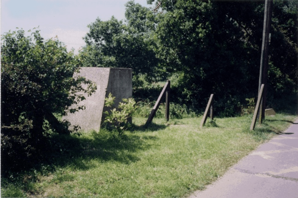
The most westerly defence structure in Nazeing is a pill box on the banks of the River Lea. This can still be clearly viewed from the tow path on the opposite bank. Between these physical structures deep anti -tank ditches were dug across the fields. These were quickly filled in after the war as they obstructed the use of agriculture machinery. There is now no trace of these ditches.

These photos are from 1993. The Pill Box on the banks of the River Lee is guarded by Anti-tank blocks which were often located close to the Pill Box as you can see here.
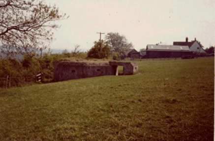
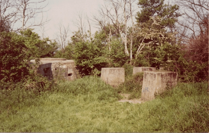
This Pill box is at the top of Old House Lane, close to Perry Hill Farm, and another at the entrance of Cemetery Lane in Perry Hill.
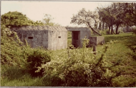
There is another Pill Box, not shown close to the footpath in Cemetery Lane. This group of three are now very overgrown, surrounded by trees and brambles and easily missed if you don’t know they are there. They were great places to play when we were children in the 1950s and 60s.
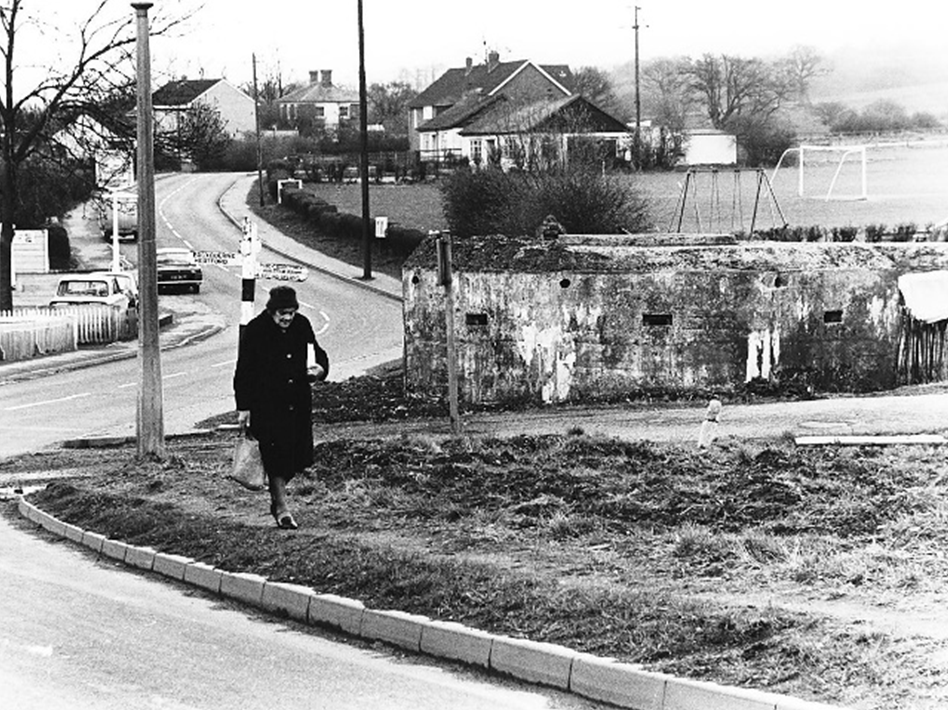
The Pill Box at Bumbles Green was still clearly visible to all in the 1980s on the south east corner of the junction, opposite the board school. This photo was taken around 40 years after the war ended. Local resident, Maggie Hutchins, is walking home towards Long Green in the foreground. Nazeing residents may remember Maggie as the mother of our valued road sweeper – Dennis Hutchins.
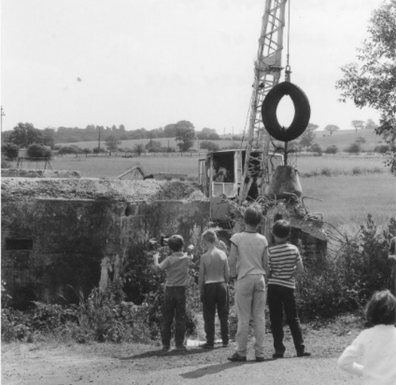
According to a local resident (Dennis Mead) this Pill Box was built with help from the Home Guard and demolished with great difficulty around 1970 to make way for the construction of an enlarged junction. Dennis was 16 years old in 1940 and grew up in Bumbles Green at the Post Office. He was a member of the village Home Guard. Stories about the Post Office can be read in our book Seventeen Miles From Town – The Story of Nazeing Part 2.
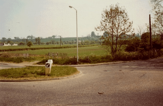
The site of the demolished Pill Box at the roundabout at Bumbles Green photographed in 1993.
These metal structures were known as “Hairpins” and can still be seen in Paynes Lane. Dragon’s Tooth were another defence structure. They were conical concrete blocks rather than the cuboid structure of the anti-tank blocks, as illustrated at the allotments in Bumbles Green.
Anti -tank blocs at the allotments in Bumbles Green
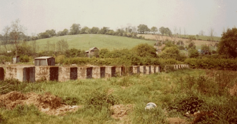
Doug Ball and Fred Nash recorded 36 anti-tank blocks in a line in the allotments at Bumbles Green, as well as two rows of three blocks north of St Lawrence Farm.
There were some other structures, recorded in 1993 as now demolished, around the King Harold’s Head and on the high ground above the common, east of Harold’s Park Farm.
The roads would have been protected with Dannert and Apron Wiring (coils of razor wire) in the event of an invasion, completing the Defence Ring. Defence posts were listed at Mamelons and Perry Hill Farms, Poona Lawn and Marshgate Farm along with Weapon Pits at the Aerodrome and Mansion House Farm. Regular troops would have been deployed to man these defences in the event of an invasion.
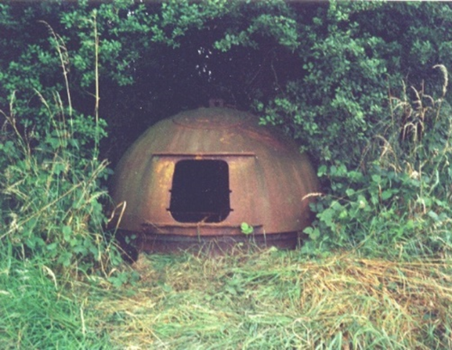
In the southeast corner of the field opposite the King Harold’s Head there was a prefabricated steel Allan-Williams gun turret, one of over a hundred issued to Eastern Command for use as strong points in defended positions. They were operated by two men, one to rotate the turret and one to fire the gun at enemy aircraft through a hatch in the top. The turrets were both intimate and private, and local gossip suggested that when two people occupied the one on Nazeing Common they were not always military personnel. By 1995 this was one of the two best preserved in the country so it was removed to Duxford Air Field and in 2000, repainted in what may have been its original colours, was part of the Spitfire Summer exhibition at the main Imperial War Museum.
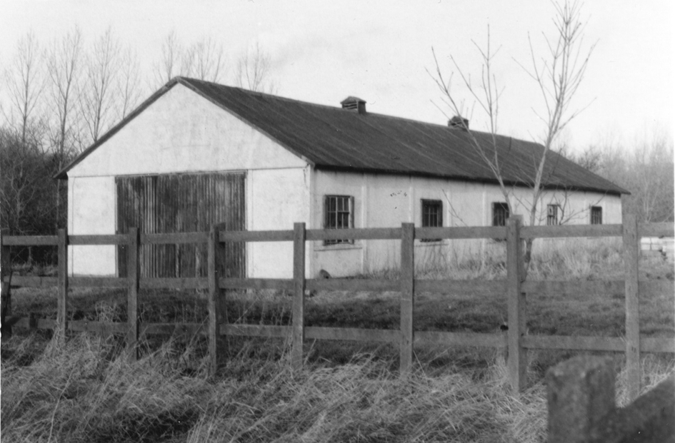
For many years a building used by RAF personnel as a barracks was a reminder of Nazeing Common’s war effort. This photo was taken in 1988 when it was being used for agricultural storage. In the years immediately after the war it was used as temporary housing, a demonstration of the extent of lack of suitable housing in village in the late 1940s.
We will explain what the RAF was doing on Nazeing Common in our next Blog.
